Humna Naveed's studio project on Governors Island integrates technology into the landscape to create more accessible and equitable public space.
Feature
Students Lead the Way
2020-21 Studio Work Rooted in Social Justice
FIND MORE AT AIANY.ORG
Image credit: Courtesy of Humna Naveed
“The students had to design their ethics, design their mission—they had to articulate it, explore it, and try to understand it. That was our base framing of the studio,” said Justin Garrett Moore, who with Alicia Olushola Ajayi taught “Mark-Marking and Place-Keeping: Erasure, Emergence, and Imagination” last spring at Columbia GSAPP, a studio that broke away from the traditional top-down assignment.
For Moore and Ajayi, the students each selected a site with a personal connection, and then dug deep into research to understand the layers of history and points of view around the site, beyond their own. What kind of design proposal might honor and acknowledge those perspectives? "The emphasis on data analysis and research into cultures and aspects of natural sciences really changed the way I thought about the project," said studio member Tristan Schendel, who after graduating in May joined NYC-based firm Smith-Miller + Hawkinson.
In addition to this GSAPP studio, we checked in with other graduate studios at schools around the city, asking how the current conversations around social justice may have influenced student work in the 2020-21 academic year. Below we highlight a few outstanding projects that speak to issues of access and equity in thoughtful and engaging ways, with more work on view at aiany.org.
Returning to Unaka
Roan Mountain, NC/TN, Tstalaguwetiyi (Cherokee, East)
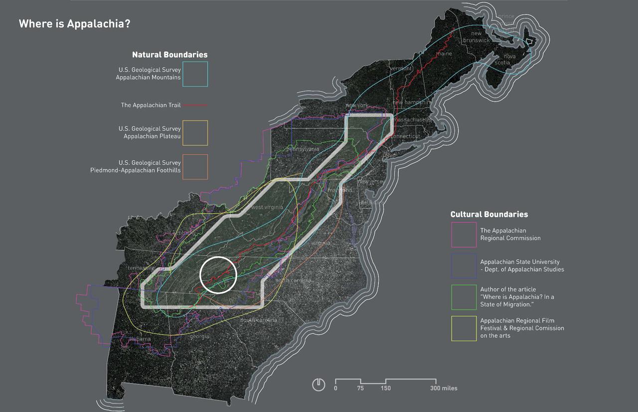
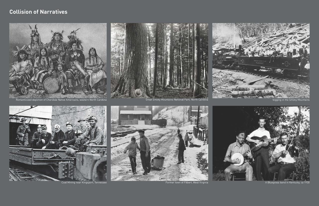
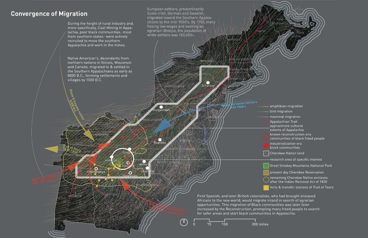
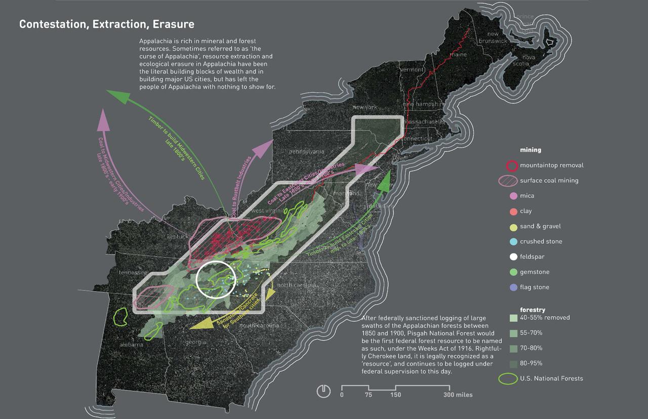
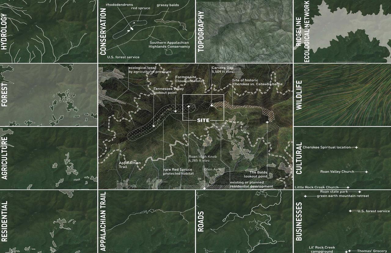
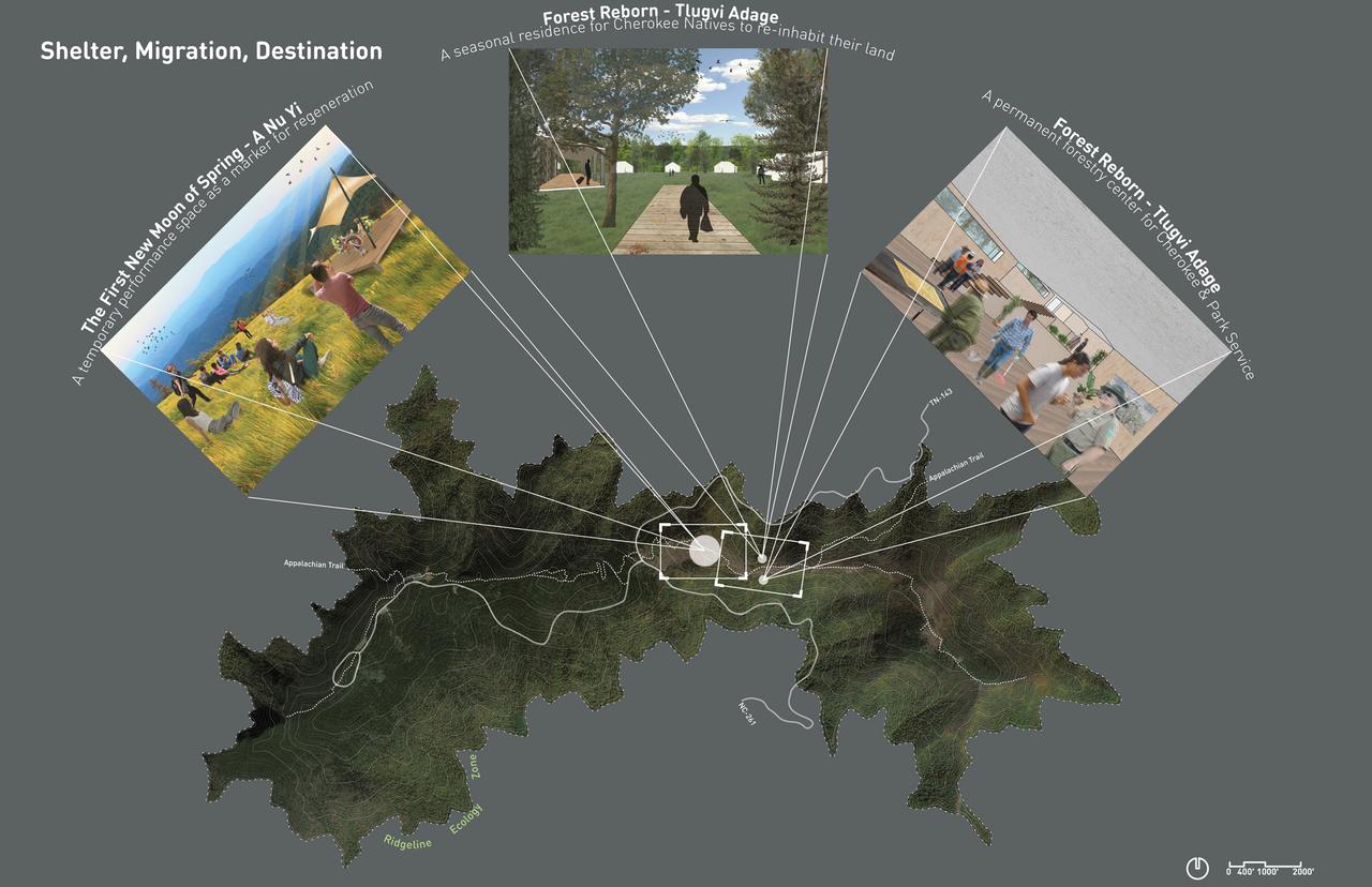
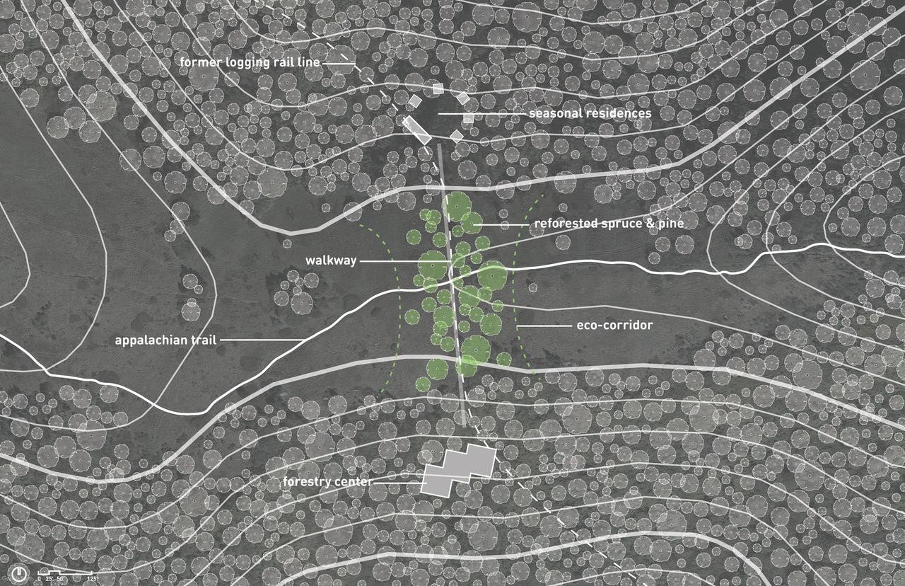
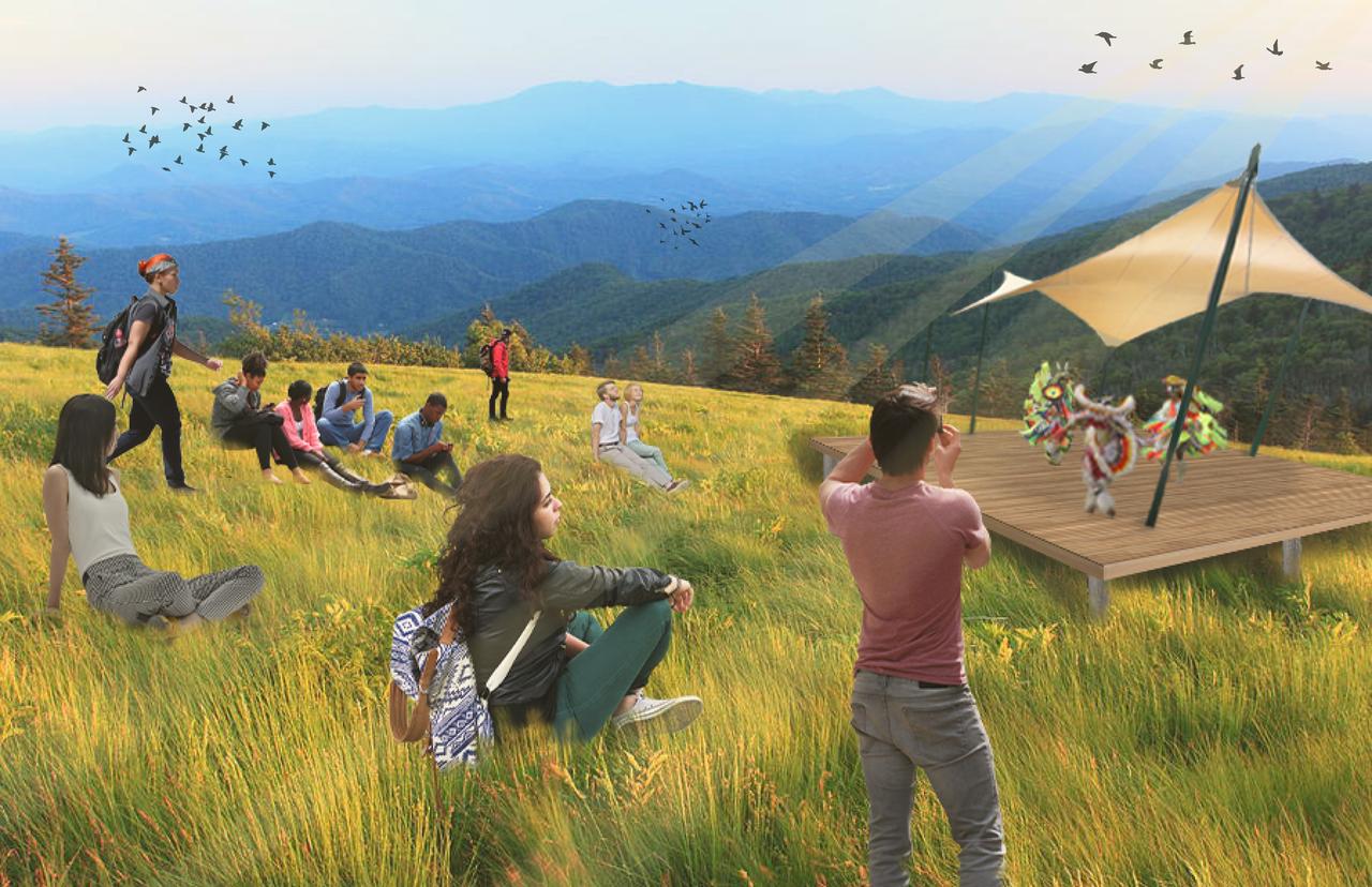
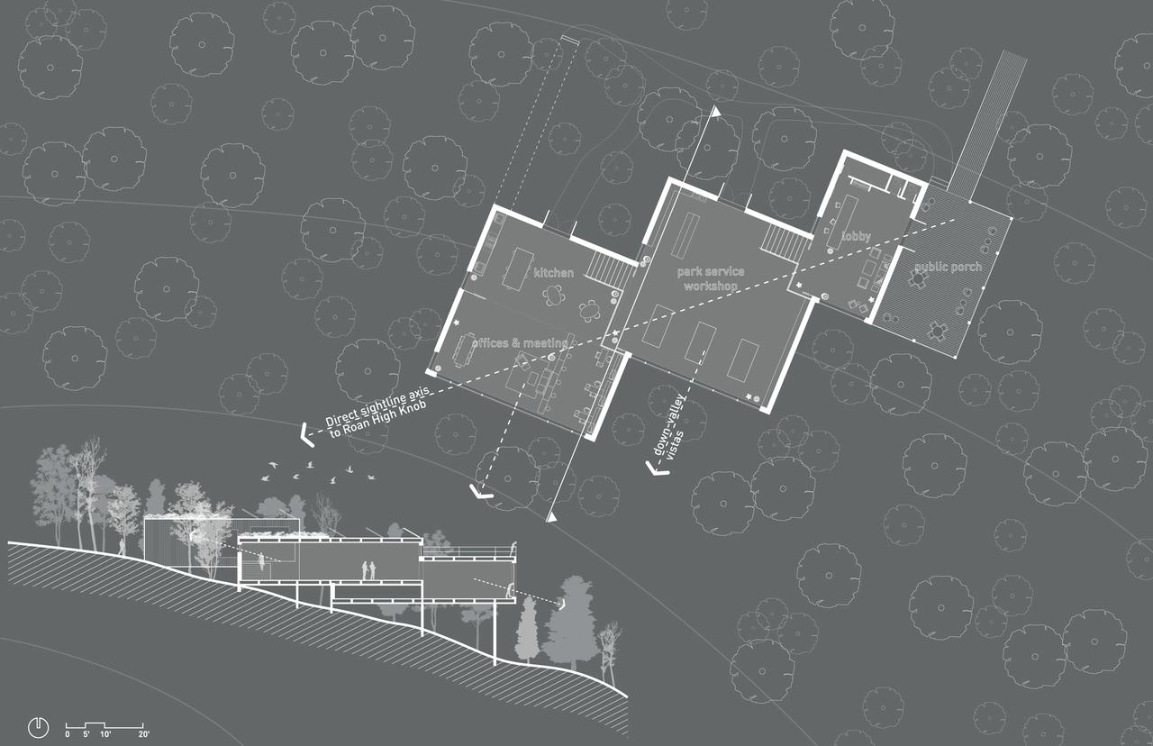
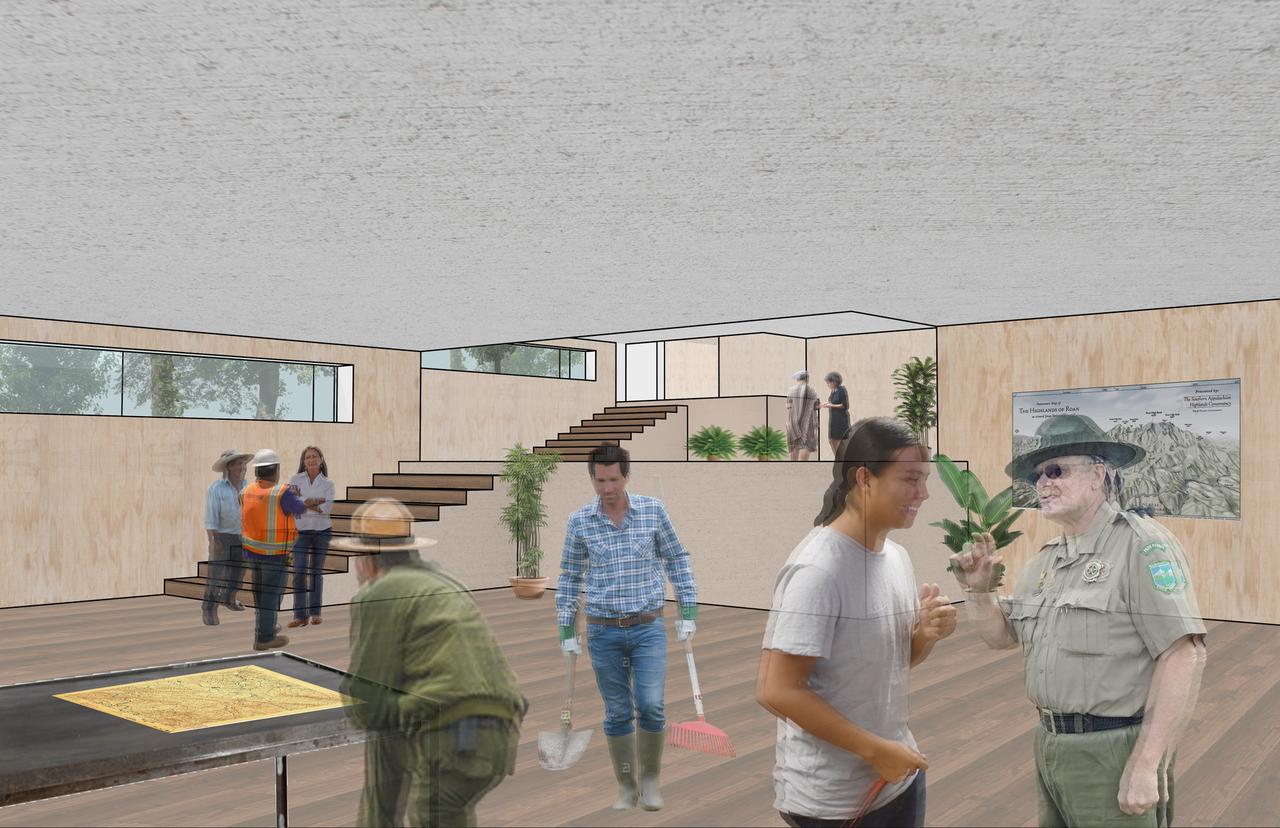
Image credit: Courtesy of Tristan Schendel
The project examines the site of the Unaka Range's highest peak, where the narratives of formerly enslaved Black people, the Cherokee, and a white settler population have intersected, providing a point of departure into the examination of cultural and ecological erasure, emphasizing design's role in fostering stewardship and a sense of history.
“Returning to Unaka takes Roan Mountain, the Unaka Range’s highest peak, as a point of entry into the interrogation of cultural and ecological erasure. As an integral and highly relevant site for regional histories of Appalachian culture, rural industries, extraction, ecological vitality and Cherokee spirituality, Roan Mountain becomes a site of contestation and multiplicity. A site where so many narratives have collided, from Black freed people and the Cherokee, to the historically white population and persistent poverty. As such, and by drawing from a vast body of regional research, this project finds itself negotiating the vital act of place-making on the one hand, the stewardship of land and ecology on the other. Narratives, stories, science, and stakeholder interviews alike have, without failure, all uncovered concepts of Migration, Shelter, and Destination. Synthesizing these concepts with today’s Roan Mountain land use, we have the unique opportunity to uncover place, foster stewardship, protect ecologies, and tell stories through calibrated design interventions—interventions that touch lightly, are experienced boldly, and, paradoxically, might not wish to be seen.” Tristan Schendel
Reclaiming Reclamation
Cilincing, North Jakarta, Indonesia
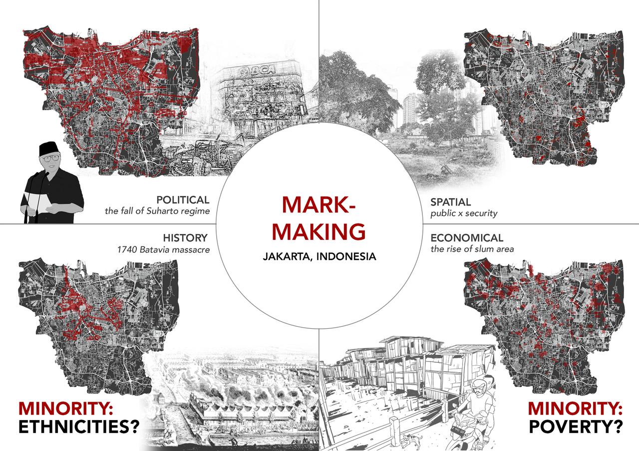
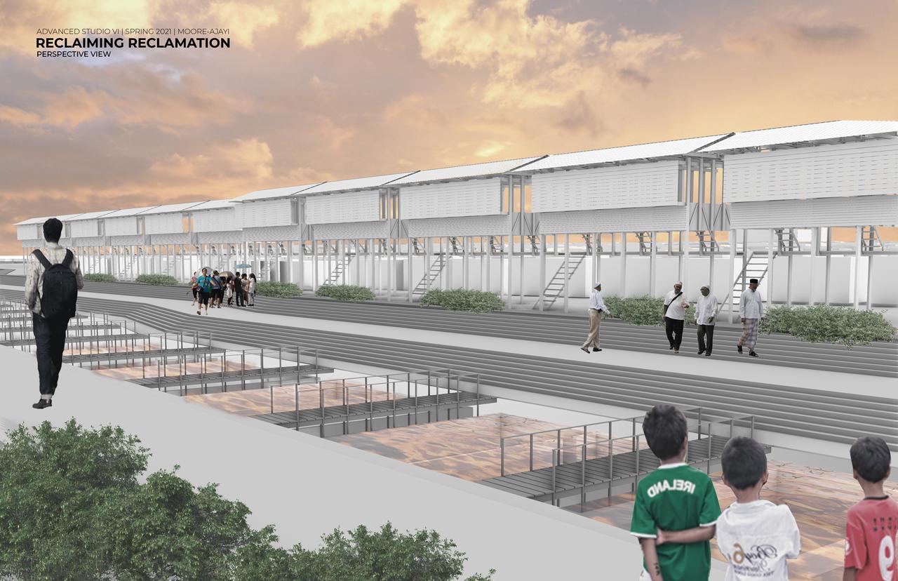
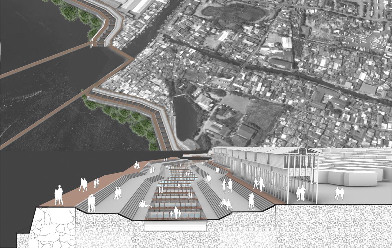
Image credit: Courtesy of Michelle Clara
A civic infrastructure proposal focuses on mangrove restoration and fish farming, aiming to give the fishing community the agency to adapt to political and environmental conditions in North Jakarta.
“Living in constant disruption of eviction threats throughout history, Cilincing Fishing Village is one of Jakarta North Coast's inhabitants who will shortly face direct ecological and political erasure. Reclaiming Reclamation aims to propose an adaptive urban infrastructure that mainly focuses on mangrove restoration, fish farming through silvofishery, and preserving the local activities. Through the ethics of care as a foundational approach, the fishing community is equipped with the elements to adapt to political and environmental scenarios. Giving this agency to the fishing community can reclaim their place and livelihood while adapting to the government reclamation plan.” Michelle Clara
Carlos J. Balza Gerardino (MS Arch ’21, Pratt)
The Outdoor School
Governors Island
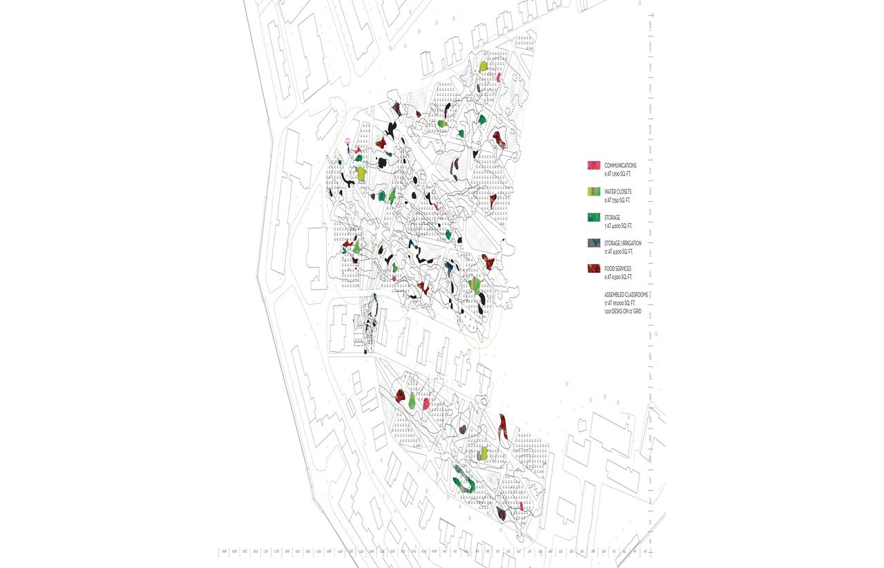
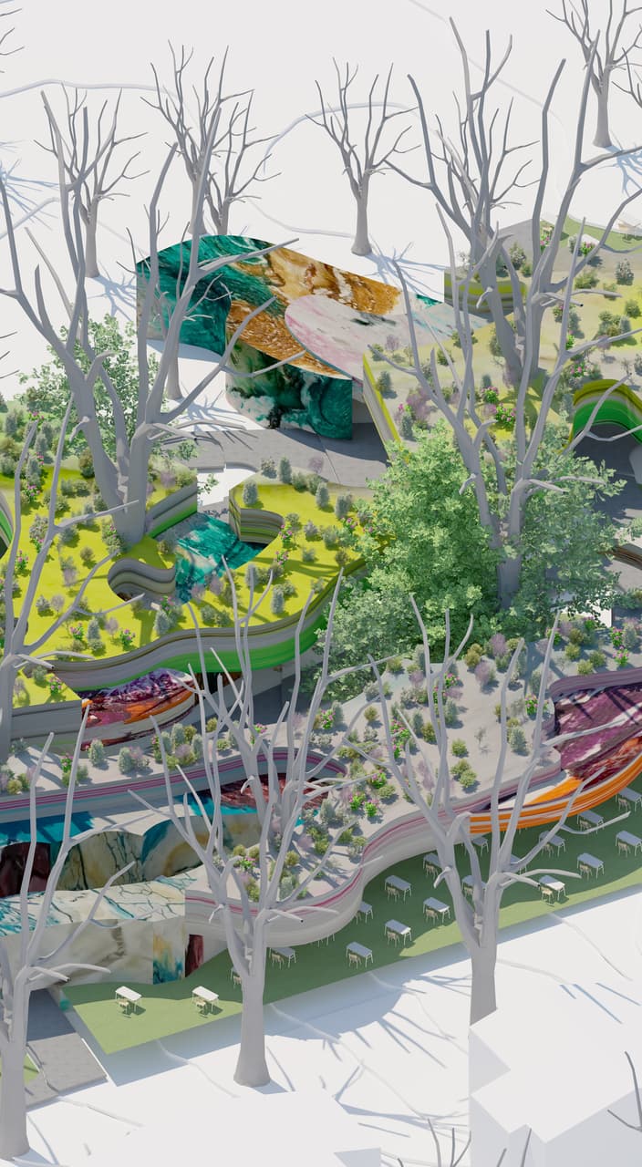
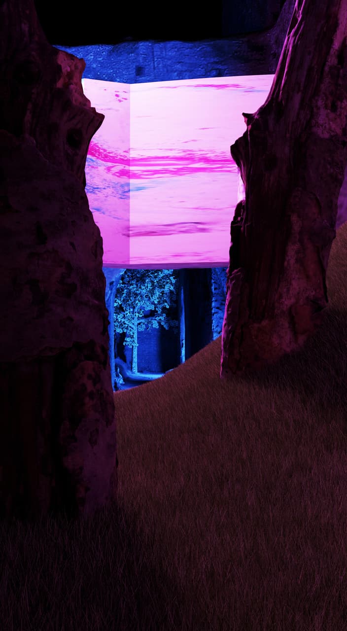
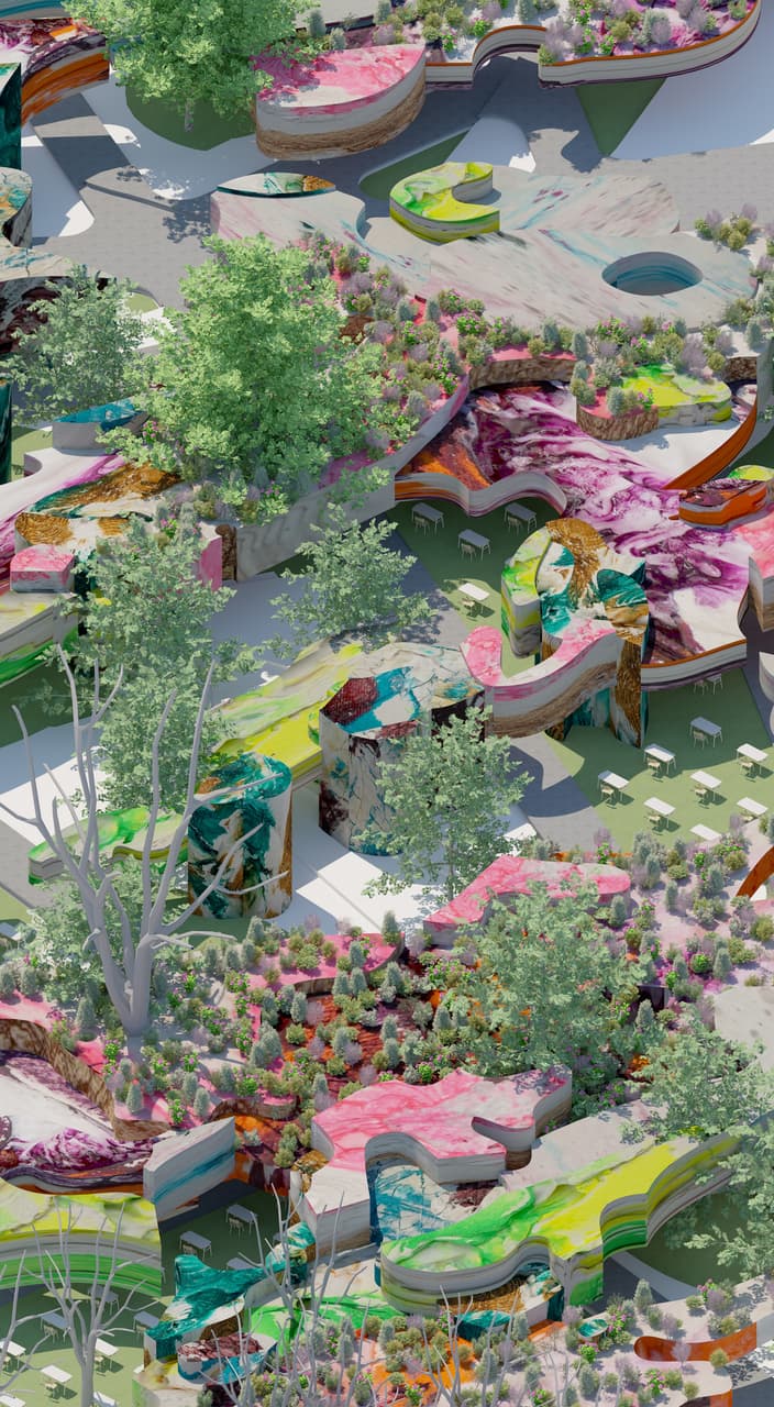
Image credit: tktktkt
The research focuses on Governors Island but encompasses six neighborhoods in Manhattan and seven in Brooklyn, gathering five school districts together and encompassing over 48,000 children, 37,000 of whom are enrolled in public schools. Thanks to its geographical location, Governors Island can aid the public education system greatly, providing auxiliary spaces for several neighborhoods. It can also expand the existing after-school curriculum and serve as an experiential learning space. This work represents research conducted in the Pratt Graduate Architecture and Urban Design, with studios taught by Ariane Harrison, Jeff Anderson, Jing Liu and Kevin Lamyuktseung.
“The Outdoor School envisions repurposing the open green spaces in the northern side of Governors Island (Parade Grounds, House 14 Side Yard, and Nolan Park) to create a semi-permeable infrastructure that can provide shade, water capture, and the necessary components—storage, food stands, and communication systems—to hold outdoor classes, physical activities, and socio-cultural interactions. The proposal takes into consideration the current response of NYC towards the pandemic of 2020 in comparison to the Influenza pandemic of 1918, and asks: How can our public education system be better prepared for the next pandemic?” Carlos J. Balza Gerardino
TerraWeave
Governors Island
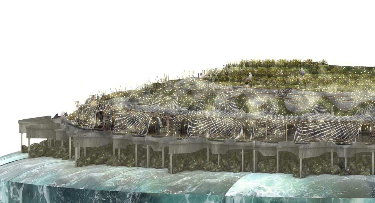
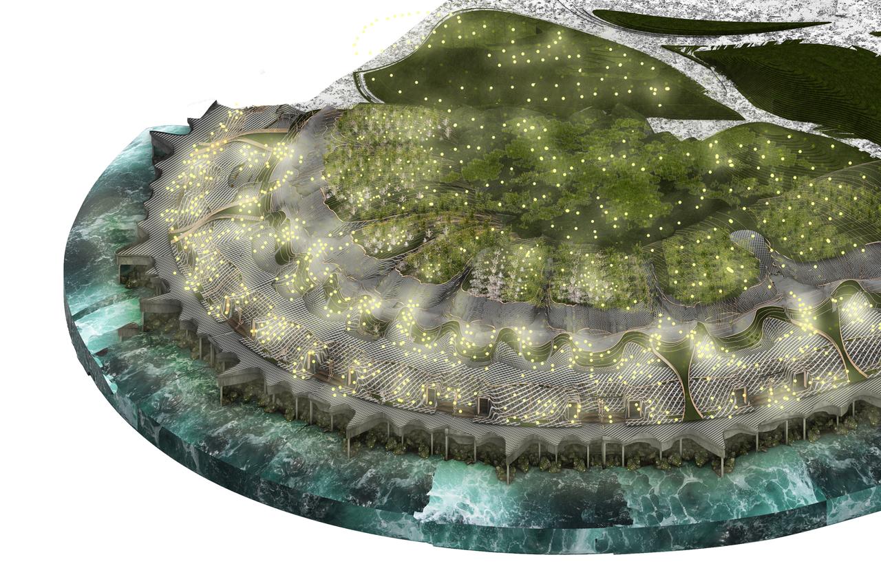

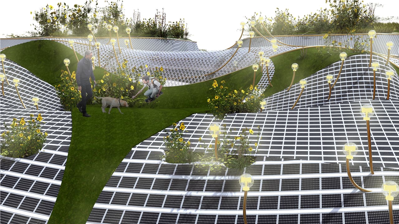
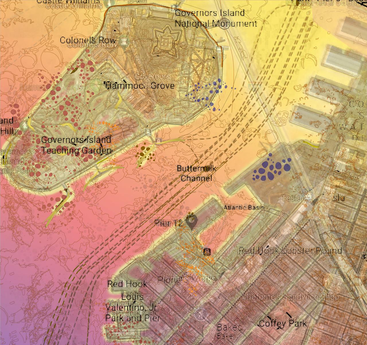
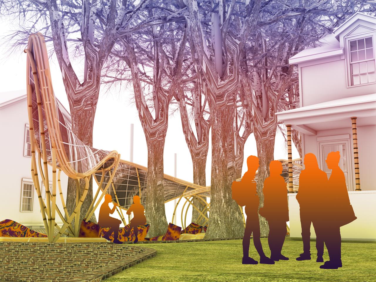
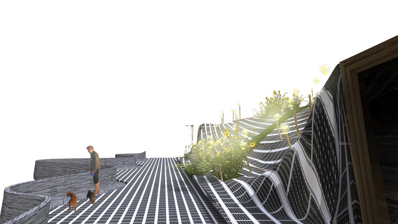
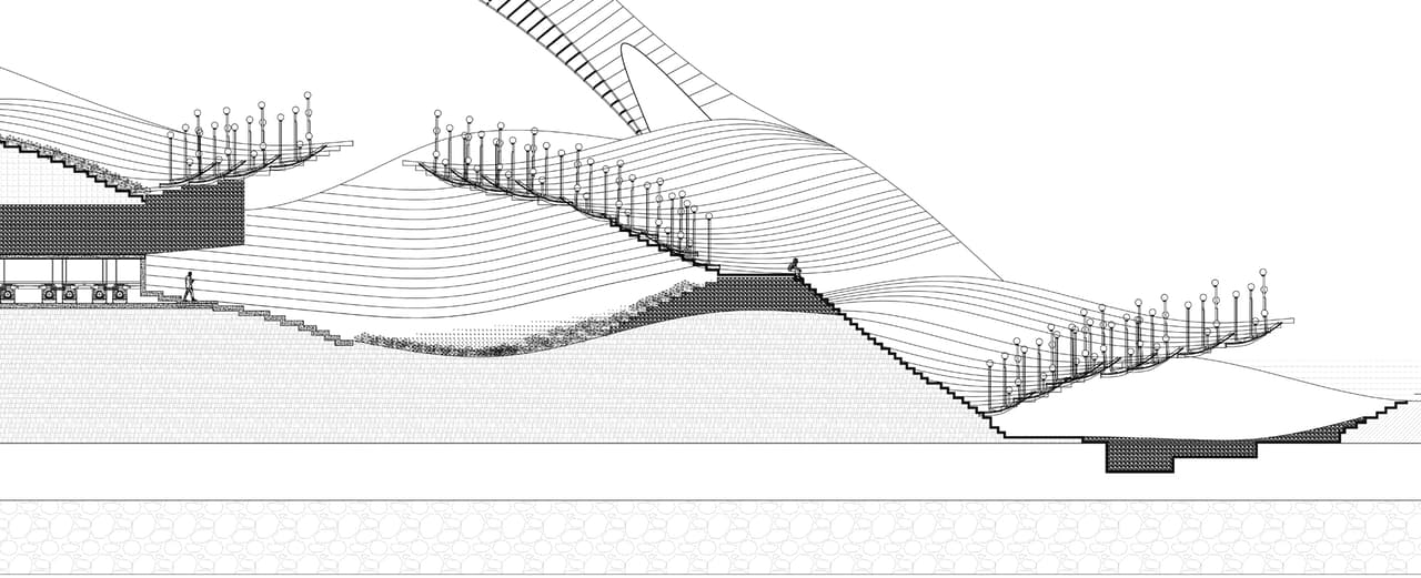
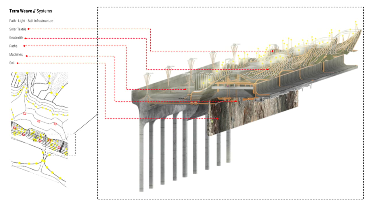
Image credit: Courtesy of Humna Naveed
The project TerraWeave looks at possibilities of intervention at Governors Island in order to increase accessibility. It considers paths and proposed walkways as potential sites for intervention and improvement by integrating the current landscape with a digital infrastructure of solar harvesting in order to transform the area into an accessible, well-lit landscape. As part of understanding solar infrastructure, the research integrates work by Sheila Kennedy, which looks at stitching nano technology of photovoltaic cells with fabrics to become a soft infrastructure that can harvest solar energy. The project explores the concept of generating new productive surfaces on three scales and tests the three scales as interdependent and operating in unison. These three scales are: a Pavilion, a digital park along shoreline, and a speculative vision for illuminating the entirety of Governors Island.
“Historically, terraforming is a tool for producing new landscapes. Governors island is a product of this and has grown from the small ‘Nut Island,’ as it was named by the Lenape, to the landmass it is today. To accommodate various programs over the course of its history, the island is a morphable surface, with its southern part a fully synthetic landscape, composed of landfill from migratory soil and construction rubble, terraformed to build an artificial landscape. The project not only engages this synthetic quality of landscape as a site but also seeks to integrate it as a technique of design to create a new accessible and equitable public park that activates the residual spaces in Governors Island, such as the yard next to House 14 and the development zone shoreline in the southern part of island.” Humna Naveed